The 2024 hiking season is just around the corner here in Utah (and already started for those brave enough to weather the snowy trails). Now, I love winter in Utah. There’s nothing like waking up to a fresh coat of snow, or seeing the mountains gradually become snow-covered. Winter also brings snowboarding and skiing season, which I love as I started learning to snowboard last season. However, once Utah starts getting those spotty warm days here and there, I’m so ready for it to stay warm. Now that April is here, I’ve started putting together my list of hikes I really want to do this year and I thought I’d share them with you all! So, here’s my bucket list hikes for 2024.
1. Angels Landing
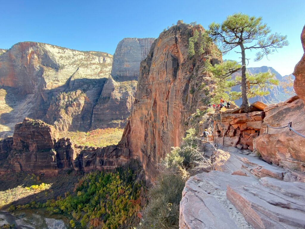
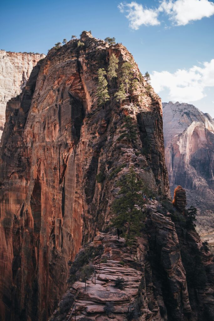
If you’ve heard anything about Zion National Park, you’ve probably heard of Angel’s Landing. It is often listed as the # 1 most dangerous hike in the United States. According to AllTrails, the hike is around 4.3 miles out and back with a little over 1,800 feet of elevation gain. It is labeled as a hard trail, likely due to the many switchbacks, elevation gain, and narrow trails. The final section of the trail, which requires a permit year round, consists of a very narrow and steep ridge with a chain along one side of the trail. Once you reach the end of the trail, you are greeted by a breathtaking overlook of Zion Canyon. If you’re afraid of heights and don’t want to complete the final section of the hike, you are still able to hike to Scout’s Landing without a permit and the views are still spectacular.
Important Info Before You Go
This hike has been on my list since moving out to Utah, but as it is one of the most popular hikes in Utah, it is very difficult to obtain a permit through the lottery system, especially during the summer months. There are several lottery drawings throughout the year:
-
- January- March to May permits
-
- April- June to August permits
-
- July- September to November permits
-
- October- December to February permits
There is also the option for day-before permits, but they are limited and you run the risk of getting to Zion and not being able to get a permit. This year, I’m going to apply for a permit for July/early August since I really want to do it this year. I was actually 30 minutes from Zion National park last weekend, but the weather was rainy and this time of year, Zion is known to be at risk for flash flooding, so we decided against it.
Zion National Park also does not allow cars in the park from March to November, so you need to take a shuttle around the park. I’m so excited to (hopefully) get the chance to hike this beautiful trail this summer/fall! I would definitely add this hike to your must-see places in Utah.
2. Sunset Peak
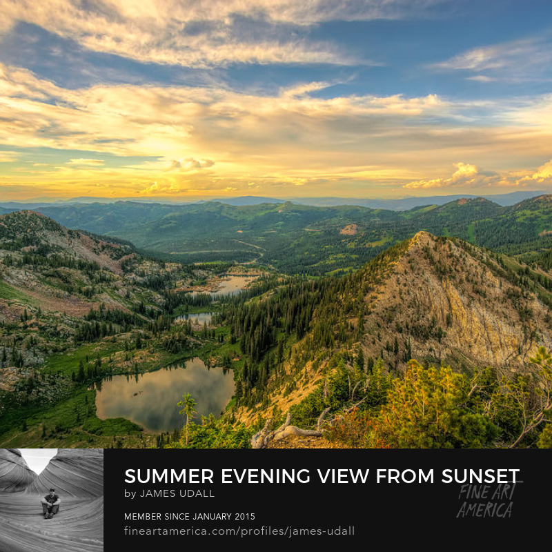
One of the goals I’ve always had was to hike to a mountain peak, no matter how big or small the mountain. Eventually, I would love to be able to hike Mount Timpanogos and King’s Peak, but I’ve got a bit to go before I am able to accomplish that. In the meantime, I found Sunset Peak, located above Brighton Ski Resort.
I found this hike recently when researching possible hikes to do this summer. Another perk of this hike is that it is a great trail to do while the wildflowers are in bloom. There are actually two trails leading to Sunset Peak that vary in length and elevation gain. The first is Sunset Peak via Brighton Lakes Trail, with a length of 5.8 miles out-and-back, and an elevation gain of nearly 2,000 feet. This trail consists of three lakes, all which are pretty early into the hike. The hike starts at a little over 8,600 feet and climbs to the peak at nearly 10,800 feet (10,788 to be exact). This trail appears to be the more difficult of the two trails. The second trail is Sunset Peak via Catherine Pass Trailhead. This trial is listed as 4 miles with an elevation gain of just over 1,300 feet.
Sunset Peak appears to be a great hike for those looking for a challenging, but doable trail. This a definitely on my bucket list of hikes to do this summer, as well as help me prep for a hike like Mount Timpanogos. For more information about these trails, here are links to the trails on AllTrails:
3. Lake Blanche
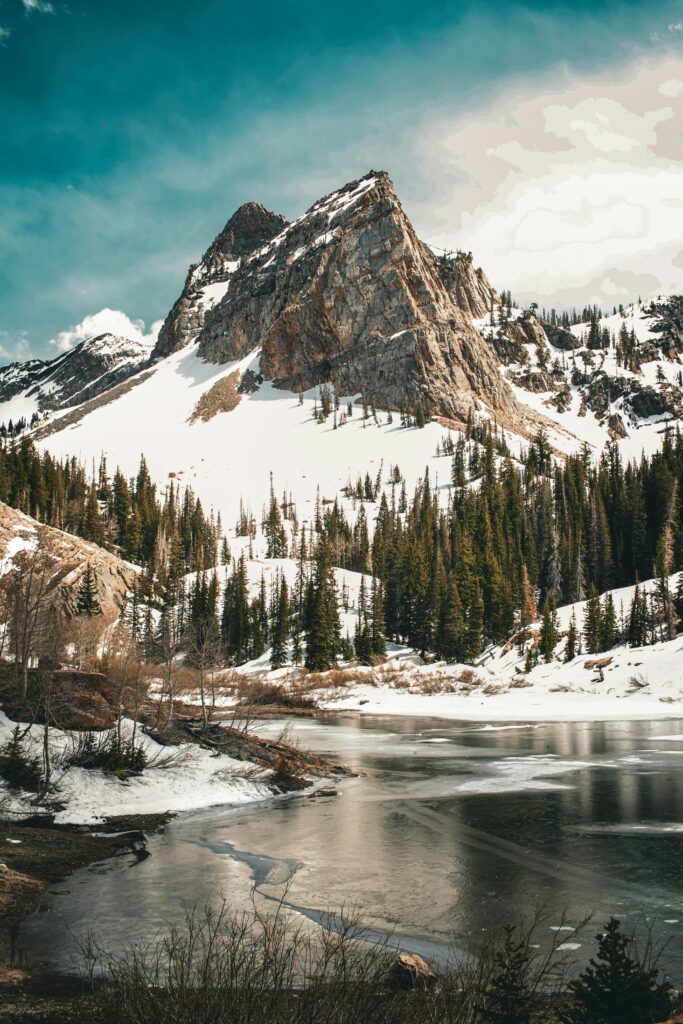
I have been eyeing this trail up since last year when I really started looking into hikes I wanted to do. It was my goal last season to complete this hike, but I wound up not getting out as much as I would have liked to and the trail was a bit intimidating to someone who would consider themselves more of a beginner hiker. According to AllTrails, Lake Blanche is a 7 mile out-and-back hike with a little over 2,800 feet of elevation gain. From what I’ve seen of this trail, it is not an easy trail and the elevation gain is no joke, especially for someone who came from a state with low elevation. The trail starts at just over 6,000 feet and climbs to almost 9,200 feet, so definitely take your time and bring lots of water/snacks.
Despite the intimidation of the elevation gain, the view when you reach the top is incredible. You get views of Lake Blanche and Sundial Peak. It is important to note that as it is up in Big Cottonwood Canyon and at such high elevation, there will likely be snow through spring time. If you aren’t comfortable with hiking in the snow, I would save this trail for summer or fall, and be sure to check the weather conditions before going. I like to use AllTrails to check recent reviews and pictures for trail conditions before I go on any hike. As I did last year, this is definitely the hike I want to make my goal work towards for this season.
4. The Narrows
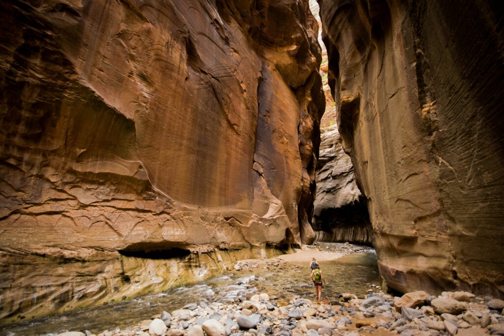
If you’re in Zion National Park, the Narrows is definitely a hike to check out. This hike is definitely not an easy one and requires you to be very prepared. Like Sunset Peak, there are two ways to hike the Narrows. The Narrows take you through the narrowest section of Zion Canyon, and most of the trail requires you to walk through the Virgin River, with areas you may need to swim through. Per AllTrails, the Top-Down hike is 16.1 miles long with just over 2,000 feet of elevation gain. However, reading through many reviews, the hike winds up being closer to 20-25 miles long. As the trail is also being hiked top down, it is mostly downhill, with some uphill towards the end of the hike, so I don’t think the 2,000 feet of elevation gain is accurate. A permit is required to hike the Top-Down trail, which can be obtained through a daily lottery two days before your intended hiking date. It is also important to note that this hike takes 11+ hours to complete and can be completed in one day, or a permit can be obtained for an overnight backpacking trip and completed in two days. The second way to hike the Narrows is Bottom Up. Per AllTrails, the hike is about 8.9 mile with just under 700 feet of elevation gain. No permit is required for the Bottom Up Trail.
Recommended Gear
As I previously mentioned, this hike requires a lot of preparation and recommended gear. The Virgin River tends to be very cold, with temperatures reaching only 56 to 68 degrees Fahrenheit in the summer. Because of this, it is recommended to bring an extra set of warm clothes, and potentially wearing a bib or wet suit in winter/spring/summer. For shoes, it is recommended to wear close-toed shoes with a good grip as the rocks in the river are often slippery. Some people opt to wear canyoneering shoes with a better grip for walking in water (a lot of people also wear neoprene socks to help avoid getting blisters). It is recommended to bring hiking poles or sticks to help navigate the water, and a waterproof dry bag is essential to keeping extra clothing and food dry throughout the hike. There are many companies that provide rental packages specifically for gear to hike the Narrows, so that is an option if you don’t want to purchase the gear. I’m really hoping to be able to hike the Narrows and plan to hike it on the same trip as Angel’s Landing. This is such a cool and unique opportunity!
5. Lofty Lake Loop
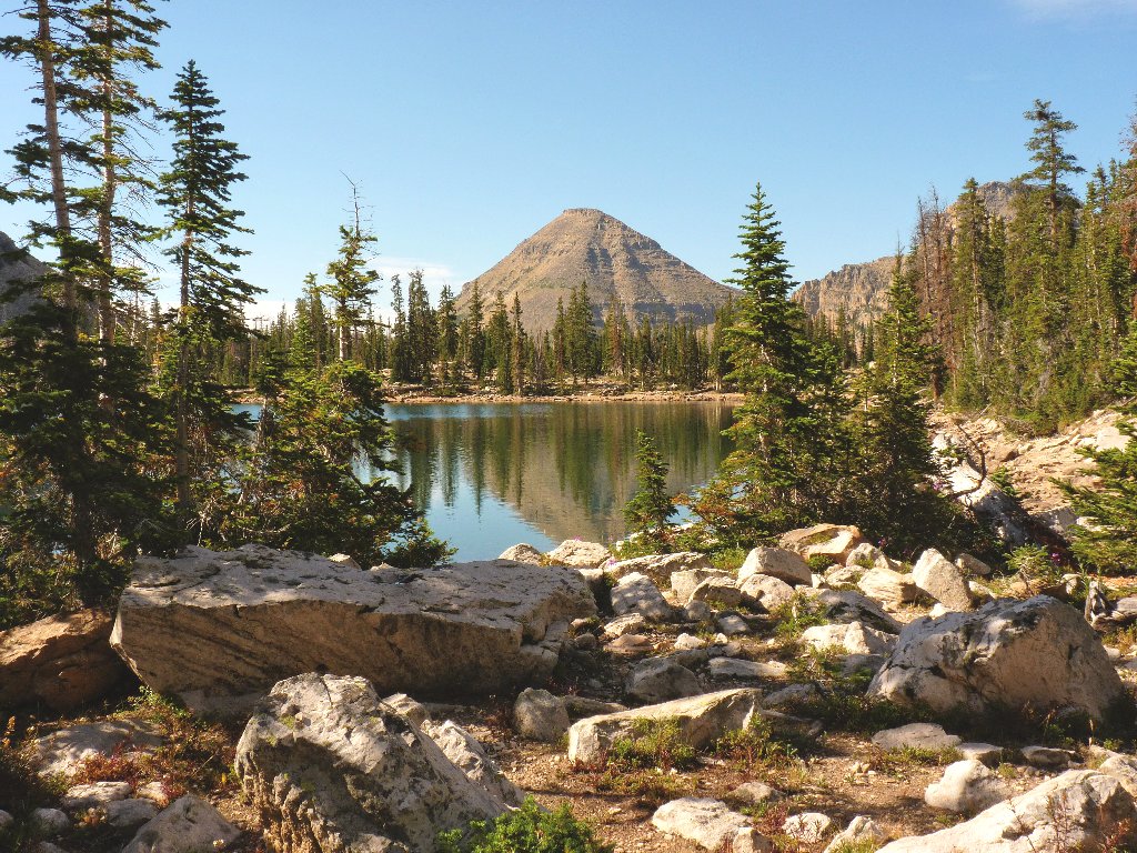
At first glance, this trail may not look like anything special, but there is a very specific reason this is on my bucket list for hikes this season. If you’re unfamiliar with Utah, you may not know that a lot of the canyons are protected watershed areas, and you are not allowed to touch/swim in the water. When looking at places that allow swimming and are not in a protected area, I stumbled across Lofty Lake Loop and was really excited to see that you are allowed to swim in the lakes if you can tough out the cold water.
According to AllTrails, this trail is 4.5 miles with 948 feet of elevation gain and can be walked clockwise or counter-clockwise, with slight variations in difficulty. Along this trail, you will come across Cuberant Lake, Kamas Lake, and Lofty Lake, all within 1 mile of one another. This trail does require either a 3-day pass for $6, or an Annual National Park pass for $45. This is a nice trail for anyone looking to possibly take a dip in the lake on a hot summer day.
Links for Angel’s Landing:
For more info on permits:
https://www.nps.gov/zion/planyourvisit/angels-landing-hiking-permits.htm
For general info about Zion National Park:
https://www.nps.gov/zion/planyourvisit/index.htm
For the shuttle schedule:
https://www.nps.gov/zion/planyourvisit/zion-canyon-shuttle-system.htm
Photo by Sapan Patel on Unsplash
Links for Sunest Peak:
Sunset Peak via Brighton Lakes Trail:
https://www.alltrails.com/trail/us/utah/sunset-peak-via-brighton-lakes-trail
Sunset Peak via Catherine Pass:
https://www.alltrails.com/trail/us/utah/sunset-peak-via-catherine-pass-trailhead
Links for Lake Blanche:
Here’s the link for the trail on AllTrails:
https://www.alltrails.com/trail/us/utah/lake-blanche-trail
Photo by Jason Alvarez on Unsplash
Links for The Narrows:
Link for the Daily Lottery (it says Canyoneering, but includes the Narrows):
https://www.recreation.gov/permits/4251918
For more info about the permit:
https://www.nps.gov/zion/planyourvisit/narrowspermits.htm
For more info about the Top-Down Narrows hike:
https://www.nps.gov/zion/planyourvisit/virgin-river-narrows-information.htm
For more info about the Bottom-Up Narrows hike:
https://www.nps.gov/zion/planyourvisit/narrowsbottomup.htm
For more info about recommended gear:
https://www.nps.gov/zion/planyourvisit/narrowssafety.htm
Photo by Yansi Keim on Unsplash
Links for Lofty Lake Loop:
For more information about the trail:
https://www.alltrails.com/trail/us/utah/lofty-lake-trail
Photo by Ted Muller
